Thursday, December 17, 2020

Final Blog Post

Living on the road was a great adventure and this blog was intended for our family and friends to keep tabs on where and what we were doing.  The postings were usually a couple of weeks after the fact, but we tried to keep it current.  Originally, our plans were to live three years on the road, never be afraid to make changes.  Our adventure's now include boating on the Great Lakes during the summer and traveling the remainder of the year.  We are selling Moose the motorhome, since we are no longer living in it. 

We enjoyed sharing our experiences and places visited along the way and hope you all retire, have a chance to do anything you want, when you want and where you desire.  Our travels will continue, however we will not be keeping up this blog.  

Thanks for traveling with us.

Darlene and Deck.

Black pins are the National Parks.


Sunday, October 18, 2020

Road Trip 1st stop The Great Smokey Mountains Tennessee

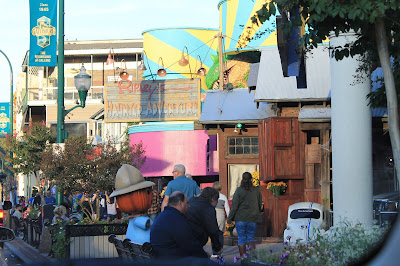
To get into the National Park we drove through downtown Gatlinburg.  It was bumper to bumper and everyone was out walking around enjoying the beautiful day.  From one side of town to the other took us 1 1/2 hours to drive 8 miles to our destination for a hike.  


We hiked Jakes Creek Trail to Avent Cabin.    Here are pictures along the trail out to the cabin, it was about 2.7 miles out and back.  The out is all an incline of a 482 ft. 


To reach the cabin it's a little tricky catching the smaller trail that leads out to the cabin.  We just happen to stop and notice some steps a trio of backpacking campers stopped to chat, they were looking for the trail to Avent cabin and thought it was about where we were stopped, we told them about the steps we found so we all hiked out the trail and it was to the cabin, yeah!


Elkmont Ghost Town in the park is where we parked to pick up the hiking trail.  The fireplaces remain and some of the foundations along the trail of a resort area that was once established in the park.  There is a campground called Elkmont that looked like a great place to camp.


Nothing like a walk in the woods.


Sunday, October 4, 2020

 We traveled in September along 23 and Lake Huron, over the Mackinaw Bridge onto 2 along Lake Michigan passing through Manistique, Gladstone, Escanaba then down route 35 west into Wisconsin.

FAYETTE HISTORIC STATE PARK / SNAIL SHELL HARBOR

Historic town site from 1867-1891, once a bustling iron smelting community.  


Taking a short hike up the rocky cliffs to capture this view of the town and harbor.


THE TOWN HALL


HOTEL
The park was a self guided walking tour allowing you to enter the structures and read the history about the town and the people a great place to visit.


KITCH-ITI-KIPI  - PALMS BOOK STATE PARK

This park is north of Manistique and well worth the trip, take the self operated barge platform ride with a glass opening for viewing the natural springs and fish below.   An abundance of trout live in river.


MANISTIQUE   -  The next 3 pictures are  along the boardwalk, you climb on rocks that take you out to a cement pier to the Manistique East Breakwater Lighthouse.


WE STOPPED IN ESCANABA AND DISCOVERED THIS INTERESTING STORY ABOUT MARY AND THE SAND POINT LIGHTHOUSE. 1868-1886


THIS IS THE CHEQUAMEGON-NICOLET NATIONAL FOREST 
NORTHERN WISCONSIN
We camped here several days and enjoyed being on Bear Lake.  Just outside the campground area we discovered the Rat River Recreational Trail which we rode our bikes over 12 miles through beautiful woods following the Rat River. 


WISCONSIN
EGG HARBOR, FISH CREEK, STURGEON BAY
DOOR COUNTY - PENINSULA & WASHINGTON ISLAND

We spent only 2 days camping in the area and definitely worth coming back to spend a week alone in this area.  We spent 2 days driving around the area, shopping and eating.  There are shops, art galleries and restaurants galore.    


A view of the waterway into one of the marinas.


We had lunch at this restaurant facing the harbor.

Thursday, March 12, 2020

Tortilla Flat, McDonald Trail-head, Cedar Flat Road, Tonto Natural Bridge, Camp Verde, Arizona


Tortilla Flat is a funky little town East of Phoenix past Apache Junction.  It has an ice cream parlor, bar/restaurant, and a souvenir store at the end of Canyon Lake. 


A small row of businesses in Tortilla Flat, see the guy hanging?
A view of  Canyon Lake.

Canyon Lake is one of four reservoirs that were formed by the damming of the Salt River.  The lake was formed by the Mormon Flat Dam, completed in 1925.

Along the drive out to Tortilla Flats are the Superstition Mountains.


Deck wanted a picture of the cactus that attacked him last year, they are known to jump onto unsuspecting hikers, from experience he knows they do!
Every turn offers a different view.

This is a hiking trail head and the pictures that follow are from that hike.

A view from the trail looking over the valley.

Our destination the caves along the rocky ridge.

As we got closer to the caves it was very steep.

The terrain was rough and uneven.

Glad I have good hiking boots.

Cedar Flat is a two track  OHV  road 10.8 miles point-to-point located near Camp Verde in the Coconino National Forest.   After hiking the McDonald trail we were ready to take a drive.

There are so many views all around you every where you go.
There is a drop off on the left side of the road.

This was an entry to a ranch that we thought looked pretty cool.


About an hour from Camp Verde is the Tonto Natural Bridge State Park.  The drive was up to 7,100 feet, another mountain range that still had snow on the ground in places with large pine trees.  We descended into the park at about 4,100 feet.


A 300 foot trail with uneven steps.

As you can tell there were a a lot of uneven steps.


Water was dripping off the rocks on the trail from a small waterfall.

Tucked away in the valley surrounded by a forest of pine trees, Tonto Natural Bridge has been in the making for thousands of years. It is believed to be the largest natural travertine bridge in the world. The bridge stands 183 feet high over a 400-foot long tunnel that measures 150 feet at its widest point.


This view is above the bridge .

A little closer view.

We hiked to the bottom and there were caves.

At the bottom there wasn't a trail just big rocks to crawl over.

Were back on top of the bridge looking at the other side.

The opening from the other side.